Well, not quite in space. More like from space.
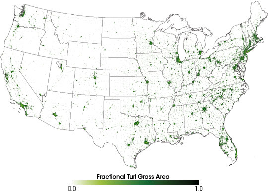
In 2005, NASA scientists studied just how widespread lawns are and compiled the above map from satellite imagery. Here's what they found:
(S)cientists who produced the map estimate that more surface area is devoted to lawns than to any other single irrigated crop in the country. For example, lawns appear to cover more than three times the number of acres that irrigated corn covers. The large image shows a more detailed look at fractional lawn surface area in urban areas. In many cities, the urban core – where buildings, parking lots, and roads are densest – appears paler green.
You can read more about the study here.
Latest from Lawn & Landscape
- Develon unveils -9 Series heavy excavators
- News you might've missed last week
- Lifescape Colorado's Hupf moves to regional role as Ostheimer becomes president
- Your most reliable predictor of success
- LandCare names McCallon, Miller as branch managers
- Takeuchi-US names Paul Wade, Eric Wenzel as dealer development managers
- CASE continues partnership with country artist Jon Pardi
- Greenlee debuts new battery-powered remote pruner